Saturday, October 18, 2008

BATCO Memo to City Council Regarding the Shanahan Acquisition

Boulder City Council
Open Space Board of Trustees
OSMP Staff
P.O. Box 791
Boulder, CO 80306

Re: Shanahan Acquisition
Date: October 13, 2008

The Boulder Area Trails Coalition (BATCO) has evaluated the proposed OSMP Shanahan acquisition and wishes to take this opportunity to offer our observations and recommendations.

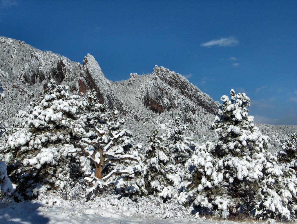
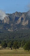
1) We appreciate the historic, agricultural, aesthetic, and urban-shaping values that this property provides the City of Boulder, and we agree that it should be preserved from development.

2) Some level of protection from development was provided in 1983 when the City paid the Shanahan family $1.9 million for the “development rights.” It is rather surprising, therefore, that the City now feels the 1983 agreement is “too vague” and actually might not prevent more than the two building units it spells out. Yet the Shanahans have had the exclusive use of that $1.9 million, as well as the property itself, for the intervening 25 years.

3) It is our understanding that the property could not be subdivided into more than two building sites under any circumstances, due to state law and county regulations, without being annexed into the city (an unlikely occurrence).

4) Given these facts, the purchase price is of great concern. The city would be paying another $6.6 million to purchase the fee interest, bringing the current total net present value of the 179 acres to $10.72 million, or more than $60,000/acre. We would be interested in obtaining more information about the appraisal that the City may be relying on to justify this value, inasmuch as other very nice agricultural properties in nearby Boulder County are currently valued at approximately $30,000/acre.

It would be very surprising if a buyer other than the City were willing to pay such a high per-acre price for this property given that it already comes with a significant development rights restriction. Moreover, an open market buyer would demand immediate occupation of the property, whereas the City is allowing the Shanahans to remain as long as they wish –potentially another 30 years.

5) The proposed purchase price for this one property alone exceeds the value of all infrastructure improvements for the entire OSMP budget by a factor of 15!

6) We believe that the law of diminishing returns has begun to kick in – specifically, these acquisitions at ever-increasing prices may no longer be appropriate in terms of value delivered to the taxpayers of Boulder, because acquisitions by necessity come at the expense of long-deferred maintenance and new infrastructure such as trails and trailheads.

7) If, notwithstanding our strong concerns with the merit of this acquisition, Council still believes the purchase is warranted, we note that the Shanahan property offers several opportunities for passive recreational values. According to the City Charter, recreation should receive equal consideration with the other values mentioned in the OSMP agenda packet. Specifically, we would like to see a trail around the northwest rim of the property, which would offer spectacular views of the mountains, valley and plains, and would provide a meaningful loop and connection of the existing trails from Greenbriar Blvd at Fairview High School to the South Boulder Creek trailhead on Hwy 93. We would also like to ensure that the Shanahan property will facilitate long-sought trail connections across Hwy 93 to the existing (but currently dead-ended) South Boulder Creek Trail (see map attached).

8) We believe that these trails need not inconvenience the Shanahans and their agricultural operation for the duration of their tenure on the property.

We balk at the extraordinarily high price of this particular acquisition. If it is to be acquired, it should come with a commitment to reasonable public access in the near future.

Please feel free to contact us for more information. Thank you for considering our comments.


The BATCO Board of Directors

Thursday, August 21, 2008

BATCO Map Retail Outlets

Berthoud

  • Berthoud Feed, 603 3rd Street
  • Nightwinds Tack, 357A Mountain Ave

Boulder

  • Ace Hardware, 2486 Baseline Road
  • Active Imprints, 629E South Broadway
  • Barnes & Noble Booksellers, 2915 Pearl Street
  • Borders Books, 1600 Pearl Street
  • Boulder Bikesmith, 28th Street & Arapahoe Avenue
  • Boulder Convention and Visitors Bureau, Boulder Chamber of Commerce, 2440 Pearl Street
  • Boulder Gas, 2900 Baseline Rd.
  • Boulder Gas, 2700 Baseline Rd.
  • Boulder Gas, 2995 28th St.
  • Boulder Horse and Rider, 4593 Broadway
  • Boulder Map Gallery, 1708 13th Street ( order online here )
  • Boulder Mountaineer, Broadway & University
  • Boulder Public Library Gift Shop, 1000 Canyon Street
  • Boulder Running Company, 2775 Pearl Street
  • Boulder Sports Garage, 2705B Spruce Street
  • Cadeaux / Millennium Harvest House Hotel, 1345 28th Street
  • Colorado Book Store, 1111 Broadway
  • CU Bookstore, University Memorial Center ( order online here)
  • Cutting Edge Sports, 2626 Baseline Road
  • Eads News & Smoke Shop, 1715 28th Street
  • Eldorado Canyon State Park Visitor Center
  • Eldorado Corner Market, 1805 South Foothills Highway
  • Farfel's Farm, 906 Pearl Street
  • Fleet Feet Sports, 2624 Broadway
  • Foxcreek Mobile Equine Outfitter, 1750 30th Street
  • Front Range Anglers, 629B South. Broadway
  • Front Range Pet & Supply, 1140 South Boulder Road
  • Full Cycle, 1211 13th Street
  • Full Cycle, 1795 Pearl Street
  • Jones General Store, 1370 College Avenue
  • McGuckin Hardware, 2525 Arapahoe Avenue
  • Neptune Mountaineering, 633 Broadway
  • Page Two, 6565 Gunpark Drive
  • PDQ Gas Station & Food Store, 5200 Manhattan Circle
  • Performance Bicycle, 2450 Arapahoe Avenue
  • Pedestrian Shops, 1425 Pearl Street
  • REI, 1600 26th Street
  • The Dickens Store, 1705 14th Street #141
  • The Puddle, 3100 28th Street
  • TrekStoreBoulder, 2626 Baseline Rd.
  • Trident Booksellers & Cafe, 940 Pearl Street
  • Troubadour Books, 5290 Arapahoe Avenue
  • USDA Forest Service Boulder Ranger District
  • Vecchio's Bicycletteria, 1833 Pearl Street

Broomfield

  • Borders Books, 1 West Flatiron Circle Village

Brighton

  • Brighton Feed, 370 North Main

Estes Park

  • Trail Ridge Outfitters, 358 Elkhorn Avenue

Hygiene

  • Clark's Food Store, 11809 North 75th Street
  • Cole's Country Corner, 7507 Hygiene Road
  • Colorado Horse Rescue,10386 North 65th Street
  • Hygiene Feed, 7455 Hygiene Road

Lafayette

  • The Tack Collection, 1355 Forest Park Circle, Suite 100
  • Joe's Bike Shop, 2770 Arapahoe Rd #110

Littleton

  • Colorado State Parks, State Trails Program, 13787 South Highway 85

Longmont

  • Ace Hardware, 1727 North Main Street
  • Acme Bicycles, 1801 Hover Road
  • Bike-n-Hike, 1136 Main Street
  • Blue Sky Cycles, 600 South Airport Road
  • Borders Books, 1101 South Hover Road
  • Boulder County Parks & Open Space, 5201 St Vrain Rd
  • Colorado Animal Health,1351 Sherman Drive
  • High Gear Bicycles, 504 Main
  • Murdoch's Ranch & Home Supply, 2255 Main Street

Louisville

  • City of Louisville, Dept. of Land Management, 749 Main Street
  • Front Range Pet & Supply, 1140 S. Boulder Road
  • Louisville Cyclery, 1032 South Boulder Road
  • Cutting Edge Sports, 1817 Hwy 42 Louisville

Loveland

  • Latigo Lariat, 3611 South Lincoln Avenue
  • Westside Feed, 5623 West Highway 34

Lyons

  • Bitterbrush Cycles, 324 Main Street
  • Greenwood Wildlife Rehabilitation Sanctuary, 5761 Ute Highway
  • Redstone Cyclery, 27 Groover Drive
  • Town of Lyons Visitor Center/Chamber of Commerce/Parks & Recreation

Mead

  • American Pride Co-Op, 201 3rd Street

Niwot

  • Niwot Rental and Feed, 291 2nd Avenue

Nederland

  • Guru Sports, 20 Lakeview Drive
  • Old Town Books, 176 Highway 119 South
  • Nederland Chamber of Commerce/Visitors Center, Highways 119/72 & First Street
  • Nederland Feed and Supply, 45 East Second Street

Other BATCO Map Sponsoring Organizations

  • Boulder Backroads Marathon
  • Mason Media

Monday, June 30, 2008

Boulder County Parks and Open Space Statistics

I thought I would share a few tidbits on BCPOS:

  • $357M+ spent on acquisitions (actual $, not adjusted for inflation)
  • Nearly 88,000 acres acquired
  • 35% of all land is conservation easements
  • Visitors may not set foot on 79% of all BCPOS land !!!
  • 69% of Heil Ranch is CLOSED to all visitor access.
  • 90 miles of trails. Trail density is 0.7 miles of trail per square mile of land, which is lower than RMNP and IPW, and only 35% of that of OSMP. Even subtracting out CEs, BCPOS has less than 1/2 the trail density of OSMP (which is already lower than other major near-urban parks).

Does BCPOS have the highest level of visitor restriction of any major park / park system in the world ????

-- Peter Bakwin

Saturday, June 21, 2008

Analysis of Acquisitions and Trails: 1967-2007

City of Boulder Open Space and Mountain Parks Department
Analysis of Acquisitions and Trails: 1967-2007
by Peter Bakwin
(pbakwin@comcast.net, 303-589-6269)
31 May 2008

Three years ago the Boulder City Council passed the Visitor Master Plan for the Open Space and Mountain Parks Department (OSMP). What has happened since then? Where is Open Space headed? In order to have a background to address these questions, it is useful to understand what OSMP is today and how it has functioned in the past. Open space is the "crown jewel" of Boulder city government. People move here expressly for the access to open space for hiking, trail running, dog walking, bicycling, rock climbing, paragliding, horse riding, wildlife viewing and the unspoiled mountain backdrop. Open space is a huge economic engine for the city, driving everything from gear shops to a large fraction of the tourist business in town. There is no question that the program has been spectacularly popular and successful. Which is why OSMP is one of the largest departments in the city, with 85 employees and an annual budget of $22 million (from sales taxes).

From 1967 through 2007, OSMP spent $337 million (inflation adjusted to 2007) to acquire over 38,000 acres of land, and together with the original Mountain Parks (Open Space merged with Mountain Parks in 2001), OSMP has protected 45,000 acres. Including debt service, the city has spent well over $1 billion on open space acquisitions in the last 41 years.

The City Charter specifies a number of non-prioritized purposes for open space, which can be summarized as: habitat and resource protection, passive recreation, to control growth and limit sprawl, to maintain our agricultural heritage, and for floodplains. I looked at the 398 OSMP property transactions during 1967-2007 and determined whether or not each parcel is open and accessible to the public. Closed space consists of conservation easements (CE, including development rights), some agricultural lands, sensitive habitat from which visitors are excluded, and parcels that simply have no designated trail access. Currently, about half (48%) of all OSMP land is open and accessible to visitor access for passive recreation (this calculation assumes that 100% of the 6,399 acres of non-CE land that was transferred to OSMP from Mountain Parks in 2001 is open to visitor access).

My analysis shows that 91% of the land acquired in the first decade of the open space program (1967-1976) is open and accessible. Land acquired subsequently is increasingly inaccessible to the public: 51%, 29% and less than 4% of land acquired in the second (1977-1986), third (1987-1996), and fourth (1997-2006) decades of the program is currently open to visitors. This startling trend points to a major shift in the way open space is managed, and an undeniable movement away from the balance of open space uses that existed at the beginning of the program.

One factor (but definitely not the only one) in this shift is an increasing reliance on acquisition of conservation easements, as opposed to purchasing property in fee. Overall, about 11% all OSMP holdings (not including Caribou Ranch) are CEs, and this proportion is increasing (see figure).


Another way to address this trend is to look at the trails themselves. Unfortunately, OSMP does not have detailed records regarding when individual trails were built. So, to address the history of the trail network I looked at trail maps going back to the earliest OSMP map, which was published in 1987, as well as 1997 and 2002 paper maps, and also a spreadsheet containing detailed data on all current OSMP trail segments. Using this information it was possible to calculate the total mileage of designated trails for 1987, 1997, 2002 and the present.
In 1987 the city had about 22,500 acres of open space and 94 miles of trails, for a trail density of 2.7 miles of trail per square mile of land (see table below). Over the next 20 years OSMP doubled its land holdings, but added only 35 miles of designated trails. Many of these trails existed previously as undesignated, (“social”) trails, OSMP simply made them official. By 2007 the trail density had dropped to 2.0 miles per square mile. The highest density of trails has always been in the Mountain Parks areas, which I define as all OSMP lands west of Broadway between Eldorado Springs Drive and Linden Avenue. Many of these trails (such as the Mesa Trail) were established decades before the first open space sales tax initiative in 1967. Currently, the trail density in the Mountain Parks is 3.3 times that of the rest of the OSMP system. The Mountain Parks have 57% the trail miles on 29% of the total land area (Caribou Ranch, which is managed by Boulder County, is excluded from this analysis).

The table shows trail density in each year in units of miles of trail per square mile of land. Data are shown for the entire OSMP system, Mountain Parks only (MP), and outside of the Mountain Parks (OS).


Outside of the Mountain Parks, the density of trails built during the last 20 years (1987-2007) is 0.76 miles of trail added per square mile of land acquired, just 40% of that built during the first 20 years of the program (1967-1987). In these areas just 1 mile of trail has been added (designated) per year over the last 20 years! Assuming a trail construction cost of $15 per foot for the OS areas (which have generally gentle terrain), about $81,500 per year (2007 dollars) was spent to build trails in these areas. This is less than 1% of the amount spent on acquisitions (capitol only) during the same period (1987- 2007). Many of the trails added since 1987 are on properties acquired before that time, so the trail density on newer parcels is even lower. These facts bring up several questions: Is the trail density of the Mountain Parks too high? Was the density of trails built in during 1967-1987 too great? What is the reason for the shift away from providing trail access to our public lands?

It is useful to compare OSMP’s trail density to other parks and park systems. Some are listed in the table below. Individual parks, such as Horsetooth and Lory in Larimer County, South Mountain in Phoenix, and Mt. Tamalpais near San Francisco, are probably most comparable to OSMP’s contiguous Mountain Parks region. No doubt the managers of Horsetooth, Lory and Mt. Tamalpais, which have higher trail densities than our Mountain Parks, feel that their parks are being managed in a manner that is consistent with environmental protection. South Mountain receives 3 million visitors per year in an area 36% of OSMP, and with 45% of the trail miles of OSMP. Boulder’s OS areas, which are 71% of the total OSMP area, contain a trail density that is more comparable to Rocky Mountain National Park and the Indian Peaks Wilderness than to other near-urban parks.


Trail density is an objective metric that is easily expressed and comprehended, and is directly comparable to other park systems. One way that objectivity could be added to the TSA process is adoption of a trail density target for the entire OSMP system, with densities in the PRA, NA and HCA zones adjusted appropriately to achieve this overall value. This would greatly reduce the acrimonious nature of the debate over every potential trail project, as everyone would know that there are density standards to be met for the entire system. The work would become a matter of deciding how to allocate the allowed trail miles.

The dramatic drop in trail density has occurred during a time when area population and open space visitation have greatly increased. The result is inevitable: overcrowded trails, overflowing trailhead parking lots, damaged and eroded trails. Adding trails would dilute visitor impacts (fewer users per trail mile) and encourage visitors to say on designated trails. Resource damage is exacerbated by insufficient trail maintenance. For example, the department does not have a full-time trail maintenance crew. With more trails in currently underserved areas (especially, east of the city), and greater focus on maintenance, natural resources would be better protected while providing a high quality visitor experience.

The OSMP budget vastly favors acquisitions over trails. Currently, about $3.4 million is spent annually on acquisitions, $11 million for debt service, and just $450,000 for new visitor infrastructure, including trails and trailhead improvements. The budget is two-thirds acquisitions and just 2% for trails. The land acquired by OSMP is increasingly far flung and disconnected from existing holdings. Most of these parcels are acquired essentially for the sole purpose of stopping development. Further, land costs have soared: the average price per acre is now more than double what it was 20 years ago, in inflation-adjusted terms. During 1967-2007 OSMP spent an average of $8.2 million per year to acquire an average of 936 acres, so the current budget for acquisitions is about 40% of the 41-year average. In 2007, the city acquired the outlying 80.8-acre Stratton Property for $3.2 million. Hence, with current budgets and land costs, OSMP is now able to purchase less than 100 acres per year, about 10% of the 41-year average.

The analyses presented here show that Boulder’s OSMP program has shifted from a reasonable balance among the Charter purposes towards increasing limitation of visitor access. These days, few acquisitions are made with any realistic probability of allowing future access for recreational purposes. Trails are highly concentrated in the Mountain Parks areas west of the city, and trail density is decreasing overall, forcing visitors to utilize increasingly crowded trails. Unnecessary resource damage occurs because the department is focused (philosophically and via the budget) on acquisitions at the expense of maintenance and improvement of visitor infrastructure. Reversing these trends would be good for the City of Boulder, its citizens, and the Open Space program itself.

BATCO June 2008 Report to BOC and it member groups

Boulder Outdoor Coalition --
(Please forward this to anyone who you think might be interested.)

The Boulder Area Trails Coalition has recently conducted a couple of brainstorming meetings in which we've asked the question, "What can BATCO (in cooperation with other outdoor recreation groups) do to promote public land management policies that do a better job of balancing environmental preservation, recreation, and land-use goals?"

The good news is that we came up with lots of great ideas. The not so good news is that it's going to take a fair number people to successfully implement these ideas. Still, if we could find a way to work together, there are more than enough people with the skills and enthusiasm to do the work.

People have also suggested repeatedly that BATCO, with its umbrella recreational mission and modest financial resources (from the Map sales), is in a position to act as a focal point in this effort. To encourage people to join BATCO while also remaining members of the other recreation groups, BATCO has also decided to waive all membership dues at this time.  So come on, everyone, join up!

We would now like to highlight a number of areas in which people suggested that we could work together to promote awareness of open space management issues and potential solutions.
  • Routine Attendance and Presentations at OSBT, POSAC, City Council, and Other Meetings -- It was mentioned the Friends of Boulder Open Space is pursuing a program in which they apparently send representatives to all open space-related meetings (including County Commissioners and POSAC). These representatives not only report their observations back to the larger group, they routinely take advantage of open comment periods to highlight issues of concern to their members.  It would be really helpful to the cause of trail advocacy if BATCO and BOC member organizations could work together on a similar program, with representatives designated on a rotational basis and a reporting mechanism back to the groups so we'll all know what transpired.
  • Get Out! Column -- It was also suggested that BATCO take a more active role in helping the general public get the most out of its open space visits while also helping the public understand how pending management decisions might affect those visits. In this regard it  was suggested that we produce, for the website and possibly the Daily Camera, a regular series of articles for the Camera's (now downsized) Get Out! column.  For example, we could plan and write up a suggested "BATCO Hike of the Month." We could also ask the public to join us on organized hike/open space management field trips.  We're looking for a few willing and charismatic volunteers to help out with this one!  If you're interested, please contact any BATCO Board member for more information.
  • Impact Assessment -- Also suggested was the need for us to become more involved in the assessment of the environmental impacts of alternative visitation strategies. This could take several forms. We could encourage open-space departments to build much more meaningful public participation components into their various research programs. We could also mobilize our members to help conduct (with or without official participation) systematic environmental monitoring programs. This might, for example, include surveys of compliance with key regulations, monitoring of social trail use (perhaps by building a collection of digital photographs), the documentation of times when parking facilities are unable to meet demand, identification of incipient and inappropriate social trails that ought to be promptly closed, informal patrolling of trails to identify maintenance issues that ought to be promptly addressed (e.g. trash, squatter camps, and trail washouts).  We have already begun doing this, and it has been helpful in formulating meaningful responses to some land manager assertions.  Any natural scientists or anyone interested in making careful observations among us?  We need you!
  • Coalition Building -- There was wide recognition of the value of efforts to broaden our coalition by reaching out to local businesses (developers and outdoor recreation businesses, for example), motorized open-space recreation groups (this might require additional thought), snow sports groups, environmental groups, and land management agencies.  This outreach effort needs folks good a schmoozing.... but outreach is important and ongoing.  Sign up here if this sounds like something you'd like to help with.
  • Long-term Planning -- Still another suggestion was that we try to help put together teams of people willing to make a long-term commitment (1-4 years) to monitor and record, on behalf of the larger recreation community, the evolution of policies with respect to a particular area.
  • Anything we've missed so far?  It's not too late to add your energy and thoughts to this evolving process.  Please spread the word that BATCO is working on reinventing itself, and please feel free to attend our regular monthly meetings -- the 4th Monday of every month at REI in Boulder, 7pm.  Our next meeting is June 21.  We hope you'll join us for this ongoing discussion.

New BATCO Map Now Available!

And a final note:  BATCO has just released our new "Trails and Recreation Map of Boulder County."  This comprehensive map has been updated to show new trails, new closed areas, rec centers, fishing holes, campgrounds, and dog parks, among many other features.  It's the only map that shows who owns what, and gives thoughtful tips on trail etiquette, land management issues, and some colorful information about Boulder County's natural resources and history.  It retails for $9.95 and is available via our website at www.bouldertrails.org and at over 80 retail outlets.  As you know, proceeds from the sale of this fine product go back out to new trail construction and maintenance throughout Boulder County.  If you can think of a new way to sell maps (via your business, a contact at the Board of Realtors, another non-profit, or whatever) please give us a hand.  The more maps we sell, the more resources we can donate to trails -- for the advancement of all recreationists.

If we can manage to pull off just a few of these ambitious ideas, we could do a lot to advance the interests that we all care about.  If you and / or your group are interested in partnering with us on any of these projects, please let us know!
 
-- The BATCO Board of Directors

Peter Bakwin [ pbakwin@comcast.net ]
Guy Burgess [ burgess@colorado.edu ]
Chris Morrison [ chrismorrison1@attbi.com ]
Mike O'Brien [ mobrien1@dim.com ]
Suzanne Webel [ swebel@earthlink.net ]

Boulder County Open Space Meetings


Dear Boulder County Open Space Stakeholders:

Periodically, the Parks & Open Space Department convenes roundtable meetings with a diverse mix of stakeholder groups in Boulder County. The purpose of these roundtable sessions is for Boulder County Open Space managers to hear what's on your mind, and have a free-ranging discussion outside of an issue-driven meeting.

This year we are planning two stakeholder meetings. You are welcome to join us for either or both sessions. Managers will give very brief presentations as noted below, but the floor is open to any topic:

June 10, 4-5:30 pm: Trails/Operations Division and Planning Division

September 23, 4-5:30 pm: Natural Resources Division and Agricultural Resources Division

Location: Parks and Open Space Office, Prairie Room (map attached; do NOT use mapquest!) 5201 St. Vrain Road, Longmont, CO 80503

Please RSVP to me by phone or email one week before each meeting if you plan to attend, and let me know who will represent your group at the roundtable.

We look forward to seeing you,

Tina Nielsen
Special Projects Manager
tnielsen@co.boulder.co.us
303-678-6279

Moving forward in trail completion

Daily Camera Letter to the Editor 6/17/08

The recent articles about the Heil Valley Picture Rock trail project do not fairly portray what was an outstanding success. I have worked on many volunteer trail projects and this was one of the best organized, supported and managed volunteer trail projects I have been involved in. The trail was well designed and marked. The tools appropriate for each section were preplaced, which was a great idea considering the long walk in. The planning and leadership was excellent. Everyone involved deserves credit and a big thanks. The ATV tracks were minimal and will soon be gone. The criticism is unwarranted and the benefit was real.

However, that was not the real issue. A "not in my backyard" (NIMBY) attitude is what it is all about. Opposition to public access by a few has dominated the trail project. It continues as the Open Space Department tries to build the trail head using land that was bought for that purpose. I hope the county commissioners recognize the NIMBY problem and complete the trail in a logical manner.

Finally, I hope the commissioners acknowledge the outstanding work the Open Space Department, the volunteer organizations and the volunteers have done in creating one of the best recreational assets in the county.

MIKE OBRIEN

Boulder

Cowdrey Draw to Mayhoffer/Singletree Trail-Funding Request

Boulder Area Trails Coalition (BATCO)
P.O. Box 19726
Boulder, Colorado 80308
Attn: Board of Directors

Re: Cowdrey Draw to Mayhoffer/Singletree Trail-Funding Request

Dear Board Members:

Boulder County Parks and Open Space will be applying for a trails grant from Great Outdoors Colorado (GOCO) on July l, 2008 for grant funding to complete the Cowdrey Draw to Mayhoffer/Singletree Trail (northerly segment) which will connect the Marshall Mesa trail (Community Ditch and Cowdrey Draw trails) to the Town of Superior. Please know that these GOCO grants are extremely competitive. Part of the grant's scoring criteria is based on the project's level of matching funds and partnerships. Would BATCO be willing to become a financial partner in this project? Your financial contribution will provide the opportunity for this grant to receive a higher score, which increases the chances of this project being funded. The benefit to visitors/users and Boulder County will be that this trail segment will be constructed 5r years earlier than planned, in 2009 than 2015.

Boulder County Transportation is currently working on the construction design for the southerly segment (Mayhoffer/Singletree Trail to Coalton trail), with construction of this segment to begin in2009; this segment is being fully funded by our Transportation Department.

In Septemb er 2007 , Boulder County, the Town of Superior, and the City of Boulder completed an extensive management plan of the Marshall-Superior-Coalton trail corridor. The development of this north segment, the Cowdrey Draw to Mayhoffer/Singletree Trail is a direct recommendation from this plan. This grant application for the northerly segment would provide the final connector to creating a loop trail that includes the Marshall Mesa Community Ditch Trail, the Cowdrey Draw Trail, the Coalton Trail and the Greenbelt Plateau Trail. This proposed trail would ultimately connect to trail systems in the Eldorado Springs area; Eldorado State Park; the Chautauqua trail system, and to Boulder County's trail systems north, west and east of the Town of Superior, and the City of Boulder.

Parks and Open Space appreciates partnering with BATCO on our trail projects, and we would like to partner with your agency to complete this important trail link. With your help, we are in a much better position to make this project happen now. Please let us know by the end of June if you would be willing to contribute. I am attaching a spec sheet on project that includes a link to the management plan, which provides maps and details of the Marshall-Superior-Coalton Trail. If you have any questions, please feel free to contact me at 3 03 - 67 8 - 627 8, or E-Mail : rstewart@bouldercounty. org.

Ron Stewart
Director, Boulder County Parks and Open Space

Marshall-Superior-Coalton Trail Corridor Management Plan

Follow this link to see the entir management plan:

http://www.bouldercounty.org/openspace/management_plans/mgmtplans_pdfs/M-S-C%20Trail%20Plan%2009_18_07.pdf

Tuesday, May 20, 2008

MEASURING THE ENVIRONMENTAL IMPACT OF TRAILS

Note: This post was written prior to the creation of this blog and as part of an earlier stage in the ongoing public debate over Boulder Open Space and Mountain Parks policies. While somewhat dated, the post still raises important issues which are still relevant.

An evolving quantitative approach by Suzzane Webel


DEFINITIONS AND ASSUMPTIONS


DATA from Miller & Knight’s “Recreational Trails and Bird Communities” (COBOS, 1995)
can be extrapolated from birds to other species

BEHAVIORAL EFFECT = AVERAGE AMOUNT THAT VARIOUS SPECIES IN A STUDY AREA "CARE" ABOUT TRAILS (%) - (includes population counts, nest success, predation, flushing distance, change in heartrate, etc.).
  • Ex: “Trails cause 2%/day decrease in nest success among some bird species”
    Assume 30 day incubation period, same risk every day; Nest failure =.02/day=(.98) to the 30 power = 0.545 success = 0.445 decrease

  • Ex: “The probability of a nest occurring is 50% greater along trails than transects”

SPECIES EFFECT = NUMBER OF SPECIES IN A STUDY AREA THAT "CARE" ABOUT
TRAILS (%)
  • Ex: “15% of grassland species were found in greater abundance farther from trails”

  • Ex: “17% of forest species are found in greater abundance farther from trails”

TRAIL DENSITY = TRAIL MILES / SQUARE MILES Useful for comparing jurisdictions, amount of effective habitat, etc


  • Ex: 70 miles of trail / 50,000 ac ( / 640 ac/sq.mi.) = 0.896

WIDTH OF IMPACT = (ASSUME ANY REASONABLE WIDTH (FT))
  • Typically ranges from 0-600 ft from trail -- most measurable effects diminish beyond 100'. Assume ave. corridor width is 100’.

  • The width conversion factor is 100 / 5280 = 0.019

ENVIRONMENTAL SACRIFICE AREA = TRAIL DENSITY x WIDTH FACTOR

Hypothetical area of 100% devastation along trail inside of which no bird dares fly, no mouse dares cross, no grass dares grow -- every day, year round.


  • Ex: 0.896 x .019 = .017 ( = 1.7% of the entire jurisdiction is "devastated" by trails) CHANGE IN OVERALL HABITAT INTEGRITY = (E.S.A.) x (B.E. or S.E.) = Habitat Fragmentation Potential = The “bottom line”: What is the real impact of trails?

  • Ex: 0.017 x (-0.15) = -0.00255 (= 0.3% decrease in grassland birds)

  • Ex: 0.017 x (-0.17) = -0.00289 (= 0.3% decrease in forest birds)

  • Ex: 0.017 x (-0.445) = -0.00757 (= 0.8% decrease in nest survival)
  • Ex: 0.017 x (+0.50) = +0.00850 (= 0.9% increase in nest placement)

CONCLUSION: FOR CITY OF BOULDER OPEN SPACE AND MOUNTAIN PARKS, TRAIL USERS HAVE NO STATISTICALLY MEASURABLE NET EFFECT ON HABITAT INTEGRITY.


THE QUESTION: HOW MUCH RECREATIONAL ACCESS SHOULD BE GIVEN UP (CLOSED) TO ALLAY FEARS OF POSSIBLE REDUCTIONS IN HABITAT WHEN NONE CAN BE MEASURED???

Excerpt from "Boulder Feeder Canal Resource Inventory and Report"

Note: This post was written prior to the creation of this blog and as part of an earlier stage in the ongoing public debate over Boulder Open Space and Mountain Parks policies. While somewhat dated, the post still raises important issues which are still relevant.

2004, Pages 16-19


Prepared by Michael G. Figgs, President, LREP, Inc.


5.3.4 Historic Winter Raptor Data


5.3.4.1 Dowe Flats Winter Raptor Study


With respect to this Report, the key information from the Dowe Flats winter raptor study is that:


  • Approximately 90% of 2,018 responses to disturbance events occurred when the disturbance was within 200 meters of the raptor (p.100 & 106).

  • Raptors had the greatest responses, in order of increasing significance, to movingvehicles, stopped vehicles and pedestrians (p.80, 98, 103 & 105).

  • There was a strong positive correlation between the numbers of prairie dog raptors present in a given area, and the size of prairie dog population in that same area (p. 43, 59, & 60). So long as prairie dogs were present, the three prairie dog raptor species tolerated chronic human presence in the form of occupied vehicles, but not pedestrians (p. 69).

5.3.4.2 Christmas Bird Counts Data from the Boulder and Longmont Christmas Bird Counts (CBC) from 1980 to 2001 for winter raptors is located in Appendix 3B (Ed. not included).


Trends for winter raptor populations are described below. Long term trends were determined by averaging the first two and last two years of the 22 year period, and noting any significant fluctuations in between. Short term trends were determined by comparing the last three years of data to the previous three years, and any notable fluctuations in the final 8 years of the 22 year period.


  • Bald Eagle--has increased dramatically over the long term (up over 1000% in the Boulder CBC, and over 2000% in the Longmont CBC). The short term trend indicates that the population may be reaching a plateau. This species' population tends to track with prairie dog populations, but the correlation in recent years is not as strong as the Ferruginous Hawk.

  • Northern Harrier--the population may fluctuate dramatically on an annual basis but over the 21 year period the population appears stable.

  • Accipiters--all three species appear to have stable winter populations over the 22 year period, with a few dramatic, short term fluctuations.

  • Red-tailed Hawk--winter populations have tripled (Boulder CBC) to quadrupled (Longmont CBC) over the long term, and the population does not appear to have as much annual fluctuation as other raptor species. The short term trend is for continuing increase in the Boulder CBC and stable in the Longmont CBC.

  • Ferruginous Hawk--the long term trend is up (plus 68% in the Boulder CBC and plus 188% in the Longmont CBC); however the three year short term trend is down for both CBC's. The downward trend may due to milder winters in recent years that would not force additional hawks into habitat along the Front Range where the climate is milder than on the high plains. The downward trend appears to be a local phenomenon as range-wide monitoring indicates the population is stable or rising slightly (National Audubon Society 2002, Sauer, et al. 2001). Winter populations peaked m both CBC's in the early 1990's and then dropped after plague spread through the prairie dog population in the county in 1994 and 1995. The population in the Boulder CBC also had a peak in 1985, and dropped after a plague outbreak reduced the prairie dog population north of Boulder in 1986.

  • Rough-legged Hawk--this is the only raptor species to display a clear, long term downward trend (down 12% in the Boulder CBC, and 72% m the Longmont CBC). The short term three year trend continues the overall downward trend. It should be remembered that Roughlegged Hawks migrate great distances from the Canadian and Alaskan arctic, and may not have moved into Colorado in the usual numbers during recent mild winters. The downward trend appears to be a local phenomenon, as CBC data throughout North America indicates a stable population (National Audubon Society 2002).

  • Golden Eagle--similar to the Bald Eagle, this species has staged a dramatic increase over the long term (up 448% in the Boulder CBC, up over 1200% in the Longmont CBC). Of the three prairie dog raptors, this species shows the least positive correlation with prairie dog populations.
  • American Kestrel--appears stable in the Boulder CBC and increasing in the Longmont CBC; short term trend is up on both CBC's.

  • Merlin, Peregrine Falcon, Prairie Falcon--long term and short term trends are stable. It is the opinion of the author that the increase of Bald and Golden Eagles, although real, is over represented in the CBC data. Observations of eagles are supposed to be cross-checked to eliminate duplicate sightings, but in practice this is rarely done. According to 2001 CBC data there were 89 Bald Eagles and 57 Golden Eagles in the two count circles, which is a fairly obvious over counting of eagles. A similar bias may impact other raptor species that have undergone significant population fluctuations (this bias can work in the reverse, and thus exaggerate population decreases).


5.3.4.3 BCNA Winter Raptor Survey


Results of the BCNA project include (with comparisons to CBC data in parentheses):


  • Rise and decline of a significant Bald Eagle and Ferruginous Hawk population centered in the Boulder Reservoir--Haystack Mountain area in 1985-86. The population decline followed an outbreak of plague in the local prairie dog population. This area includes the southern 2.5 miles of the Boulder Feeder Canal study area.

  • County-wide decline of Ferruginous Hawks, Red-tailed Hawks, and Bald Eagles in 1993- 94 after another outbreak of plague. This decline was not as significant as the 1985-86 population decline at the Boulder Reservoir--Haystack Mountain area. (Both CBC's similarly track the declines of Bald Eagles and Ferruginous Hawks, but not Red-tailed Hawks, which actually increased in both CBC's in 1994 and 1995.)

  • The near total loss of prairie dog habitat east of McCaslin Boulevard in southeastern Boulder County, with a corresponding significant decline in Ferruginous Hawks and Bald Eagles.

  • A decline in Bald Eagles and Ferruginous Hawks in eastern Boulder County beginning before the 1993-94 plague outbreak. (This result does not track with CBC results, where Ferruginous Hawks in both CBC's peaked in 1993, and then declined after the outbreak of plague. By 1996 in the Boulder CBC, and 1997 in the Longmont CBC, Bald Eagle counts had rebounded and passed the 1993-94 peaks.)

  • Winter populations of Rough-legged Hawks, Northern Harriers, and American Kestrels remained steady or increased slightly from 1990-96. (This trend was consistent with CBC data for Northern Harriers and American Kestrels, but Rough-legged Hawks displayed a downward trend, particularly in the Longmont CBC. However, the strongest downward trend dates to 1996 in the Boulder CBC, and 1998 in the Longmont CBC, at the end of the reporting period of the BCNA study.) There appears to be a discrepancy between the CBC data, which shows a clear increase or stable populations for almost all species of winter raptors, and BCNA data which indicates a decline of Ferruginous Hawks and Bald Eagles. However, this seeming contradiction is resolved by looking at the time frames for the respective data sets. The CBC data presented herein dates to 1980, when most winter raptor populations were relatively low (excepting species of accipiters and falcons), whereas the BCNA data set is only fully represented from the early 1990's, when many winter raptor populations were at or near their peak. So both perspectives may be considered correct. The CBC data set simply provides a longer term perspective.

5.3.4.4 Winter Raptor Data Summary Although there is some discrepancy in the historical winter raptor data presented above, certain trends and findings are quite evident.


  • The winter populations of Bald Eagles, Red-tailed Hawks, and Golden Eagles in Boulder County have increased dramatically over the past 22 years.

  • The other winter raptors have generally maintained stable populations in the long term, with short term fluctuations being fairly common.

  • Only the Rough-legged Hawk has shown any evidence of long term winter population decline, but this trend has primarily occurred during a series of fairly mild winters.

  • Ferruginous Hawk populations most closely track the fluctuations of prairie dog populations. Bald Eagles moderately track prairie dog populations, and Golden Eagles appear to have a small but essentially insignificant positive correlation with prairie dog populations. These trends are remarkable when it is considered that from 1980-2000 the human population in Boulder County rose from approximately 190,000 to 290,000 (Colorado Department of Local Affairs 2002).

Trail Impacts

Note: This post was written prior to the creation of this blog and as part of an earlier stage in the ongoing public debate over Boulder Open Space and Mountain Parks policies. While somewhat dated, the post still raises important issues which are still relevant.

Let’s not allow political correctness to prevail over objective data regarding Boulder's Open Space and Mountain Parks' (OSMP) Visitor Master Plan. Some extreme preservationists have been decrying “habitat fragmentation due to trails” as if trails were environmental catastrophes and those who enjoy access to public lands ignorant, selfish and destructive. Many scientists, including myself, have also evaluated the data regarding environmental impacts of trails. Our conclusions differ significantly.

No one denies that humans can affect our environment. Let’s assume for a moment that all designated trails on Open Space are 100% environmental sacrifice areas 100’ wide; if so, the total impact on the OSMP ecosystem would be 1.7%. However, objective analysis of diverse data reveals that trails do not fragment habitat. A bird study commissioned by OSMP which set out to demonstrate that trails would create a reduction in species diversity, evenness, and richness compared to control areas, could find no such “trail effect.” The researchers found that the vast majority of birds showed no sensitivity to trails. The probability of a nest occurring near trails was significantly higher than along control transects, and the average probability of nest survival was identical. Another OSMP study along South Boulder Creek found no statistical difference in bird populations regardless of levels of on-trail or off-trail use. These studies show that the "millions" of Open Space visitors have no measurable net effect on habitat integrity. Colorado elk researchers have found that recreationists would have to actively harass each cow elk in a herd more than ten times a season to achieve any reduction in reproductive success. Colorado State Weed Coordinator studies show that wind, water, wildlife fur, bird scat, and truck tires are each more effective than trail users in spreading weeds. Boulder County reports that some raptor species have increased 1000-2000% in the past decade, despite enormous increases in human populations and trail use even near the birds' preferred habitats. This and other research leads reasonable people to conclude that recreation impacts are vanishingly small. Reasonable people would celebrate our relationship with open space as a success, instead of implying threats that don't exist to support a political agenda. How much recreational access should we forsake (close) to allay fears of possible reductions in habitat when none can be measured? More than 50% of our “open” space is already closed to visitor access, and the OSMP trustees want to close even more. Yet people have been frequenting these places for centuries!

Other jurisdictions joyously promote their open space programs’ benefits to their citizens (fresh air, exercise, appreciation of nature, recreation), while admirably protecting their natural resources. That's all Boulder wants: a Visitor Plan that honestly balances natural resource protection AND passive recreational opportunities. We can have both -- if we insist that Council change the paradigm from fears to benefits.

Suzanne Webel
Boulder

Boulder County Public Lands & Trails

Boulder Area Trails Coalition

Note: This post was written prior to the creation of this blog and as part of an earlier stage in the ongoing public debate over Boulder Open Space and Mountain Parks policies. While somewhat dated, the post still raises important issues which are still relevant.

It's encouraging to recreational enthusiasts that more than 2/3 of the land in unincorporated Boulder County is in public ownership (more than 60% of all the county land). The multiplicity of our public land management agencies and the diversity of the various rules and regulations can lead to confusion. Hopefully the following discussion will help clear things up.


The federal government is the largest public land manager with more than 1/3 of the county under Forest Service, BLM, National Park Service, or Department of Commerce control. The Boulder County Parks and Open Space department and Boulder City Open Space and Mountain Parks department are the next largest public land agencies (managing, respectively, more than 16% and 10% of the county). Other, significantly smaller, public land managers include Denver, Boulder, and Longmont utility departments and Eldorado State Park. Each of the land management agencies operates with it's own set of objectives and rules (and within it's own political and budgetary constraints). The table below contains some specifics of agency properties and trails.

Read the rest of this article.

Trail Densities & Effects On Front Range Public Lands

Boulder Area Trails Coalition

Public discussions about trails are often quite emotional. Questions always arise about the effects of trails on the environment and about how much public access is appropriate. A few facts may help to put the discussions in context. We've gather some statistics about publicly owned lands and trails in Boulder County and surrounding areas in the hopes the data will add some perspective.

In the following table we've shown acreages, square miles (acreage divided by 640), and miles of trails on public lands managed by various local land management agencies. As a measure of the extent of the trail systems we've calculated a trail density factor (trail milage per square mile of land managed).


Finally, we've generated a worst case measure of possible trail impacts by assuming that each foot of trail devastates an 100 foot wide corridor of land and calculating the resulting percentage impact on the total property. It's important to note that we do not believe trail effects are anyway near that severe. The few studies we hear repetitively cited clearly indicate that trail effects, when any exist, are much lower.

Read the full article and look at the trail density tables.

Adaptive Management

Guy Burgess

Note: This post was written prior to the creation of this blog and as part of an earlier stage in the ongoing public debate over Boulder Open Space and Mountain Parks policies. While somewhat dated, the post still raises important issues which are still relevant.

It's obvious that a great deal of uncertainty exists regarding the resilience of ecosystems and the impact of various human visitation options. In the face of such uncertainty one has two basic options. One can implement an extremely cautious management plan -- one that essentially excludes visitors from an entire area. While this would obviously minimize the risks associated with human visitation, it's highly probable (but not certain) that the environmental benefits of such an approach would be quite small, at least as compared with a modest, environmentally sensitive human visitation program. Taking the most conservative approach possible would still be the obvious choice, except for the fact that there are real costs associated with unnecessary visitor restrictions. These include, for example, diminished public understanding of prairie and other ecosystems, reduced public support for open space programs, and human quality of life impacts.

It is these costs which are pressuring OSMP land managers to look for ways of simultaneously pursuing both recreational and preservation objectives. In short, they are in the politically difficult position of having to decide how cautious is too cautious.

Under such circumstances is common for the parties to wish that they knew more. Better science would reduce uncertainties in the corresponding level of needed caution. It would allow land managers allow greater visitation while simultaneously maintaining or even strengthening the level of environmental protection.

The good news is that there is a practical and inexpensive strategy for reducing uncertainty. It is based on the fundamental principle that the longer you look into the future the greater the level of uncertainty. To date the visitor planning has focused on long-term decisions with the apparent goal of crafting a series of policies which would not have to be continually reviewed. To my knowledge there was little planning and budgeting for impact monitoring and the prompt mitigation of unanticipated adverse impacts. If you're going to manage this way, you it have to have very large safety margins which, in turn, force unnecessary and controversial visitor restrictions.

An alternative, adaptive management strategy would focus more attention on short-term decisions and include funding for the continued monitoring of visitation and environmental impacts. It would have the money needed to be able to identify environmental problems as they arise and then promptly take appropriate corrective measures. It would be able to act before problems got out of hand and while mitigation options were still feasible and affordable. Similarly rewarding new visitor opportunities to be added based upon visitor suggestions and continuing environmental assessments.

For example, in areas where there are concerns that visitors might allow the seeds of invasive species to "hitchhike" on their clothing, the visitor plan could include funding a systematic search for invasive species at the earliest stages of the flowering season---when they are easily identifiable and before they've had a chance to reproduce. Any plants that are found could be destroyed and if the number of invasive plants is significantly greater than those found in the control area then a broader area closure might be implemented.

As another example, in areas where there is concern that human visitation might scare away nesting birds, the area could be closed until each year's nests are firmly established. Areas without active nests could then be reopened with the entire area opened once they the nesting season concludes. Area wide closures could then be reinstituted at the beginning of the next nesting season. An area can also be monitored for the emergence of unwanted social trails with incipient trails closed before there is significant vegetation damage

Boulder Open Space and Mountain Parks Home Page

http://www.bouldercolorado.gov/index.php?option=com_content&task=view&id=3073&Itemid=1922

Boulder OSMP Visitor Master Plan


A primary focus of the Boulder Outdoor Coalition is assuring that the City faithfully implements the spirit of its Visitor Master Plan.

This is a complex document that people interested in the issus should look at carefully.

In particular we want Open Space and Mountain Parks to live up to the principles outlined in this "Policies for the Future" section:

The Plan: Key Policies for the Future
The Visitor Master Plan is intended to maintain or improve the quality of visitor experience and ensure that Open Space and Mountain Parks natural values--which make this place special--are protected and preserved. The Plan presents the following guidance:

  • Extend a sense of welcome to visitors that fosters their enjoyment and appreciation of Open Space and Mountain Parks’ special resources
  • Invest in improving and expanding the trails system to enhance visitor access
  • Focus on visitor safety, maintenance of existing facilities, and resource protection
  • Emphasize education to motivate low-impact visitor use techniques
  • Use the least restrictive means possible to reduce visitor conflict and minimize impacts on the environment [boldface added]
  • Involve the public in managing Open Space and Mountain Parks lands by providing varied ways to give input to decisions and volunteer opportunities that foster learning and tewardship
  • Follow an adaptive management approach that involves monitoring the results of management programs and allows adjustments when necessary

The plan can be downloaded from:

http://www.bouldercolorado.gov/files/openspace/pdf_VMP/Final-VMP.pdf

Boulder OSMP Visitor Master Plan Site


The primary focus of the Boulder Outdoor Coalition is the implementation of the Boulder Open Space and Mountain Parks (OSMP) Visitor Management Plan (VMP). OSMP maintains a web site with extensive information on the VMP implementation efforts at:


http://www.bouldercolorado.gov/index.php?option=com_content&task=view&id=3065&Itemid=1032

OSMP Requires Permit for 50 Yard Off-Trail Hike

Guy Burgess

The City of Boulder's Open Space and Mountain Parks (OSMP) Department has just instituted a new permitting system for off-trail travel on what will eventually be about 38% percent of OSMP land. While the permitting system represents an improvement over earlier efforts to completely close these areas, the system, as currently structured, falls short of the Department's commitment (embodied in its Visitor Master Plan) to employ the "least restrictive" policies for achieving its environmental protection objectives.

The view from one of the threatened viewpoints.

Requiring permits for significant off-trail excursions makes some sense. It allows OPSMP to advise visitors on low-impact travel techniques, warn them about especially sensitive areas, and track visitation. However, since these areas are already very lightly visited, it seems doubtful that all the hassle and expense will yield significant environmental benefits.

The bigger problem, however, is the department's decision to require permits for VERY short diversions (less the 100 yards) from what is fundamentally an on-trail trip. Under the current rules, for example, you'll have to pretty much sit on the trail and enjoy your lunch as people walk by. If you don't want to be (literally) underfoot and if you want to enjoy a little privacy and solitude, you'll need to get a permit, in advance.

You also better have access to the Web. Otherwise, you'll have to send a letter or make a trip to an OSMP office (during business hours), which may take longer than your hike. If you choose to ignore these rules, you're at their mercy. They can fine you $1000.

That's not all. You'll need a permit if you want to take a picture, but the angle from the trail isn't quite right. You'll need a permit if you want to get a better look at the Western Tanager that just flew into the tree down the hill. You'll need a permit if you hike to the top of Long Canyon and you want to walk across the road and admire the view of the Indian Peaks from the clearing 50 yards off the road.

You'll also need a permit if you take the trail around the North Side of Flagstaff or up Green Mountain and want to scamper a few yards out to one of the viewpoints. And, the way the maps are currently written, you'll need a permit to check out the view at Stoney Point.

There are also ominous hints that if too many permits are requested during the first, experimental year of the program, then OSMP will start limiting the number available. Surely the miniscule environmental impact of giving users access to a 100-yard corridor on each side of the trail would be outweighed by improvements in the quality of the visitor experience.

Still, there is one bright spot. Exemptions are granted to heed the "call of nature" (which is never really defined). It seems to me that heeding the "call of the wild" and the "call of nature" are pretty much the same thing. So, maybe we don't have to follow the rules after all.

All joking aside, OSMP's on-trail requirement is a deliberate decision reflecting misplaced priorities. I respectfully ask the City Council to ask OSMP to amend those policies.

$50,000 Available for Trail Projects

Years ago, when faced with land management agencies who were less than enthusiastic about new trails and even about maps showing where the existing trails were, BATCO had the revolutionary idea of publishing a comprehensive map of Boulder County trails and using the proceeds to actually improve and expand the Boulder County trail system. The truly remarkable thing is that this bold idea is now becoming reality. BATCO now has almost $50,000 available for trail projects throughout Boulder County. Even more remarkable is the fact that a recent grant to produce a second edition of the map means that this revenue flow is likely to continue.

This success has left BATCO with a bit of a problem: what are the best ways to spend the money?

We need your help:
- first, to identify worthwhile projects
- next, to garner community enthusiasm
- and finally, to secure the approval of the relevant land management agencies.

This is a great opportunity. It gives trail advocates a unique chance to bring real money to the table when we start advocating for improvements to the system.

Given the significant amounts of money involved, BATCO has developed the attached "request for proposals." (Keep in mind that this is a new adventure and we welcome suggestions for improving the RFP and the entire project funding process.)

BATCO is willing to consider any project idea which is consistent with our overall goal of enhancing opportunities for non-motorized Boulder County Trail users. Preliminary ideas, wish lists, formal proposals, and offers to help are all welcome.

There is real money here. How do YOU think we can best use it???

Please circulate this announcement to the members of your respective groups, friends, fellow trail users and possible corporate-matching supporters.

And, if you have ideas, that you would you think might be worth pursuing contact Suzanne Webel at 303-485-2162 or swebel@earthlink.net . At this point we are asking people who might be interested in taking advantage of this opportunity to let us know by June 1. This will give us a chance to maximize our impact on 2007-2008 trail development projects.

We look forward to hearing from you soon!

-- Guy


Boulder Area Trails Coalition (BATCO) Trail Fund
Call for Proposals

Unlike other Boulder area trail maps, revenues from the sale of the BATCO Comprehensive Trail Map of Boulder County are to be used exclusively for trail projects in Boulder County. With almost $50,000 already available in this fund as of April 1, 2007, BATCO is issuing a public Call for Proposals for Trail Projects in Boulder County. We are interested in funding the design and construction of new trails, the enhancement of existing trails, and other projects that will significantly improve the quality of the visitor experience on public lands.

BATCO hereby solicits short (approximately 2-3 pages plus a map) letters of interest from Boulder County land-management agencies, trail and outdoor recreation groups, corporations, and even individuals wishing to “champion” a trail project.
Following an evaluation of these letters of interest by the BATCO Board of Directors, BATCO will invite those with the best ideas to submit detailed proposals. We will ask that these full proposals include the following information:
  • Specific plans for the trail projects to be constructed
  • A work plan to be followed in constructing the project
  • Budget with a description of financial and in-kind contributions (including volunteer labor) to be applied to the project
  • Formal letters of support from appropriate land-use agencies whose approval and participation will be required for the project to proceed.

Letters of inquiry and formal proposals will be evaluated on the basis of the following criteria:

  • Attractiveness of the proposed project to a broad range of trail users.
  • Value-added potential. Our highest funding priority involves projects, or significant
    project enhancements, that would otherwise not be possible
  • Matching Support for the project including direct financial support and in-kind, time and
    material contributions
  • Enthusiastic "project champion" support from people willing to do the leadership work
    required to make the project a success
  • Support from relevant land-use agencies
  • Ability to successfully address environmental or historical preservation concerns
  • Ability to successfully address the concerns of project neighbors.

This is a new program of the Boulder Area Trails Coalition, and we welcome suggestions for implementing it. We also urge those interested in applying for a grant to sign up for our e-mail update list. This will allow us to notify you if any improvements are made to the program. If you would like to contribute to the project by donating money or expertise, helping us distribute maps, or promoting trail projects but can’t be a “Trail Champion” right now, please contact Suzanne Webel at 303-485-2162.

Official OSMP "Off-trail" Definition


3. What is considered “off-trail?”

Activities occurring off of a designated trail in a Habitat Conservation Area require an off-trail permit. A visitor is considered "off-trail" if he or she travels off of an OSMP designated trail or designated climbing access.

Unavoidable and incidental activities (e.g., answering nature's call, yielding to a horse, avoiding a hazard on a trail, resting or eating "beside" the trail) are generally not considered "off-trail." Going off trail for lunch, to find a quiet spot or to reach an overlook is considered off-trail.

Rangers will determine the need for a permit based on the specific intent and circumstance of a visitor being off-trail. Examples of activities requiring an off-trail permit include climbing, hiking, photography, running and bird watching.

Boulder Area Outdoor Organizations

For those interested in outdoor recreation, BATCO recommends the following organizations (which are not formally affiliated with BATCO):

Open Space: Percentages Open and Closed

Questions frequently arise about the percentage Boulder Open Space and Mountain Parks land that is actually open to the public. Two BOC members with extensive experience off their best estimates.


From Eric Vogelsberg

All the figures are somewhat inaccurate.

Of the ~43,000 acres about 7,000 is in conservation easements. For the conservation easements (like the Hogan property) the city has only restricted development. There is no fee ownership and no public access.

The fee ownership properties, about 36,000 acres, are divided into 4 categories:

Habitat Conservation Areas (13,433 acres, 38% of fee properties)

Natural Areas (14,145 acres, 41% of fee properties)

Passive Recreation Areas (4,220 acres, 12% of fee properties)

Agricultural Areas (3,291 acres, 9% of fee properties)

Note that these are 2005 figures. However there have been few significant new property additions since then.

In general public access is allowed in all of these areas, with restrictions increasing from Passive Recreation Area off-trail access to Habitat Conservation Area and Agricultural Area on-trail or by permit only access


From Suzanne Webel

The Final Draft VMP Management Areas are as follows:
38% Habitat Conservation Areas (HCAs)
41% Natural Areas (NAs)
12% Passive Recreation Areas (PRAs)
9% Agricultural Areas (AAs)

Of the 125 miles of trail on OSMP,
54 miles (43%) are in PRAs
48 miles (38%) are in NAs
19 miles (15%) are in HCAs
4 miles (4%) are in AAs

Of the total 43,000 acres,
72% are "open" to the public
19% are Conservation Easements, closed to the public
7% are closed to everyone for hazards and sensitive habitat

However, all of these categorizations are fuzzy, and many overlap. For example:
Much of the 72% "open" is de facto closed, because it is surrounded by fences and locked gates which discourage access. So the "72% open" assertion, while technically correct, is disingenuous at best.

Some of the Natural Areas are being treated as de facto HCAs, with stricter rules and no off-trail use by certain groups (such as Spring Brook Mesa).

Only a tiny fraction (less than 2%) of the HCAs are "open" to the public because they contain very few trails, the Off-Trail Permit system is only available to some user groups and not others, and then only to a tiny proportion of those groups.

Agricultural areas are mostly closed to public access.

My best calculation at this point is that about 68% of all OSMP lands are effectively closed to public access, which surely vindicates the term "Closed Space."

Saturday, May 17, 2008

City of Boulder Open Space Analysis

by Peter Bakwin

For many years I have visited the City of Boulder Open Space and Mountain Parks (OSMP) on a daily basis. During this time, I have noticed that OSMP has acquired a lot of land, but has opened very few new trails. I wondered if it is possible to quantify the priority that OSMP has placed on acquisitions vs. trails, so I started looking at the numbers.

First, some basics: OSMP employs 85 people with a budget of $22M per year, 9% of the City's total budget. In 2008, $3.4M is allocated to new acquisitions, $11M for debt service and $450,000 for visitor infrastructure (new trails and trailhead facilities). The budget is two-thirds acquisitions and just 2% for trails!

Since the first open space sales tax in 1967, OSMP has spent $337 million (inflation adjusted to 2007) to acquire over 38,000 acres of land, and together with the original Mountain Parks (Open Space merged with Mountain Parks in 2001), OSMP has protected 45,000 acres. Including debt service, the city has spent well over $1 billion on open space acquisitions in the last 41 years.

I looked at the 398 OSMP property transactions during 1967-2007 and determined whether or not each parcel was open and accessible to the public.Closed space consists of conservation easements (CEs), some agricultural lands, sensitive habitat from which visitors are excluded, and parcels that simply have no trail access. Currently, about half (48%) of all OSMP land is open and accessible to visitor access for passive recreation. What is surprising is that 91% of the land acquired in the first decade of the open space program (1967-1976) is open and accessible. Land acquired subsequently is increasingly inaccessible to the public: 51%, 29% and less than 4% of land acquired in the second (1977-1986), third (1987-1996), and fourth (1997-2006) decades of the program is currently open to visitors (see figure). This startling trend points to a major shift in the way open space is managed, and represents an undeniable movement away from the balance of open space uses that existed at the beginning of the program.


One factor in this shift is an increasing reliance on acquisition of CEs and development rights, as opposed to purchasing property in fee. Overall, about 11% all OSMP holdings (not including Caribou Ranch, which is managed by the County) are CEs or development rights, and this proportion is increasing. Other factors include acquisition of parcels that are increasingly farflung and discontinuous, the glacial pace at which OSMP evaluates new acquisitions for trail suitability as part of the Visitor Master Plan, and managementfs philosophy of keeping parcels closed unless they are specifically open.

In the next Newsletter I will look at how the OSMP trail network has evolved over the past few decades. In future, I plan to evaluate the Boulder County Parks and Open Space program using similar criteria, and to compare these programs to others along the Front Range. I can use help on this: contact me if you are interested in participating in this research.

Contact me at pbakwin@comcast.net if you would like a copy of my full report on this work.

New BATCO Website

We have redesigned our website and added a blog feature. Visit us at (http://www.batco.org)

Soon, we hope to make it possible to monetary contributions can be made via the website using your credit card (through PayPal). All communications, including the ewsletter, can now be done electronically, which cuts down on waste paper and mailing costs, and allows us to include color in the Newsletter. Paper copies of the Newsletter may still be requested by contacting any of the Board members. A new egroup will help members keep up to date on current issues.

Board Meetings

The Board usually meets on the fourth Monday of each month, at the upstairs meeting room of REI in Boulder. The meetings begin at 7PM and typically last about 2 hours. Meeting times, locations and agendas will be posted on theBATCO website: http://www.batco.org
BATCO members and the public are welcome to attend Board meetings. Please join us!

Board of Directors

Peter Bakwin, President (pbakwin@comcast.net)
Suzanne Webel, VP (swebel@earthlink.net)
Chris Morrison, Treasurer (chris-morrison@comcast.net)
Mike O'Brien (mobrien1@dim.com)
Guy Burgess (ghb-incoming@gmail.com)